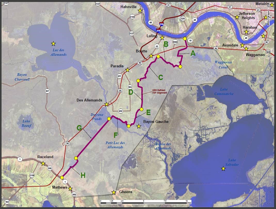
The study area for the Upper Barataria Basin is located in southeast Louisiana on the west bank of the Mississippi River in St. Charles, St. John, St. James, Jefferson, Ascension, Lafourche and Assumption parishes in southeast Louisiana.
Project Purpose and Features
The recommended plan addresses flood risk from tidal surges, coastal storm surges and rainfall. The headwater flooding from rainfall is intensified by tidal events resulting in flood damages to industrial, commercial, and agricultural facilities and residential structures. The study area contains a little over 25,000 structures in which 90 percent are residential.
The plan consists of a 30.6 mile levee alignment including 12.3 miles of existing levee/floodwall improvements. The 16-18.5 foot elevation levee would originate in Luling, Louisiana, connecting to the Mississippi River Levee via the Davis Pond Diversion Structure West Guide Levee. Continuing south, the plan would update and improve deficiencies in the St. Charles Parish Levee, crossing Bayou Des Allemands with a 270 foot barge gate structure, and would then continue parallel to Hwy 90 where it ties into high ground near Raceland.
Project Status
The Upper Barataria Basin Chief’s Report was signed January 2022. The project requires authorization and appropriation to proceed to construction. Funding was received in the amount of $8 million to begin Pre-Construction Engineering and Design.
