In its natural condition, the Mississippi River regularly overflowed its banks and meandered back and forth across the floodplain. For thousands of years, Native Americans accepted the whims of the river and adapted to its patterns. The arrival of European settled in the early 1700s, however, brought a radically new perspective on the river's habits. The river's tendency to flood was a serious hindrance to settlement and development--a problem which demanded solutions.
Early inhabitants began constructing earthen embankments (called levees) along the river's banks to contain the flow and protect residents and developed property. The French built levees to protect New Orleans as early as 1717.
At the turn of the 19th century, a crude system of levees extended for 100 miles upriver of New Orleans, with individual landowners constructing and maintaining the levees.
By the 1830s, states were becoming involved in flood control on the Mississippi River through both direct funding and the creation of levee boards. These boards took over levee construction and maintenance with funds acquired from taxes on landowners. |

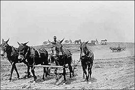
Levees - major public projects in the late 1800s. |
Despite these efforts, flooding continued throughout the 19th century with major floods in 1844, 1850, 1858, 1862, 1865, 1867 and 1874. Some of these floods were immense, causing great misery and destruction along the river. As a result of these floods and the ravages caused by the Civil War, the levee system was in a devastated condition by the 1870s, and appeals for federal involvement grew with each flood event.
For many years the U.S. Army Corps of Engineers was responsible for keeping the river open for navigation, but had little role in flood control until Congress established the Mississippi River Commission (MRC) in 1879. The MRC, initially headquartered in St. Louis, Missouri, relocated to Vicksburg, Mississippi, in 1929. It was charged with developing and implementing a comprehensive plan to improve navigation and prevent destructive floods. Engineering studies of the river were undertaken and many improvements to navigation were accomplished. In the area of flood control, the MRC assisted local levee boards by developing reliable levee standards and new construction techniques. Actual construction of flood control features by the MRC, however, was severely limited by Congressional directives and largely confined to repairing crevasses (breaks in the levee).
Initial federal involvement significantly improved flood protection but it was still less than satisfactory. Great floods in 1882 and subsequent years plagued the valley as levees were overtoppcd or crevassed. These disasters and the rising flood heights between the levees caused many to question the total reliance on building levees to contain the river's flood waters. Other approaches to improving flood protection -- reforestation of the floodplain, cut-offs to speed up the river's flow, reservoirs to hold back flood waters, and floodways to divert flows away from the main channel were suggested but always rejected by the MRC in favor of a "levees only" policy.

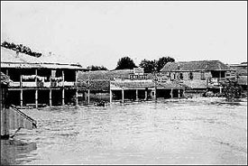
Even with improved levees, flooding continued to
plague communities along the river. As shown, floods inundated Point Coupee Parish in 1912. |
The MRC's role grew with each flood, finally culminating in the Flood Control Act of 1917, which authorized the MRC to construct an extensive program of flood protection with cost-sharing by states and local interests.
The program maintained the "levees only" approach and included new levee construction and strengthening of existing levees to standards set three feet above the high water of 1912.
By the end of 1926, the improved levee system had successfully passed several major high water events. These successes convinced the MRC and the public that the flood control problem was nearly solved. |
The false sense of security in the Lower Mississippi Valley vanished in the flood of 1927, a natural disaster of great proportions. This tremendous flood extended over nearly 26,000 square miles, killed more than 500 people and drove more than 700,000 people from their homes.
Thirteen crevasses in the main Mississippi River levees occurred, demonstrating that even the largest and strongest levees would not alone protect from flooding. |

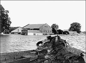
Domestic animals huddle on the remaining levee crests in the submerged town of Bordelonville, LA during the flood of 1927. |