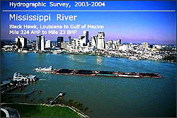
 | | 2004 Hydrographic Survey Book Cover Download by chart location
(pdf or dgn formats) | | Last Updated 11-04-2009 - Updated sheets 19, 89, 91, 92, 96 The 2004 Mississippi River Hydrographic Survey Book consists of 98 map sheets mapped to 1:20,000 publication scale and 21 map sheets mapped to 1:10,000 scale. The book maps the Mississippi River from river Mile 953 AHP at Cairo, IL to the Mile 23 BHP at Gulf of America.
Each map sheet is available for download in Adobe PDF format and MicroStation Version 8 DGN CAD format. Printed versions of this map may be purchased from New Orleans District Map Sales. Also other book versions are available online from our Maps & Data pages. |