This is not the most current version of Atchafalaya River Navigation Charts and should be used for historic reference only. For current charts please see the Geospatial Home Page.
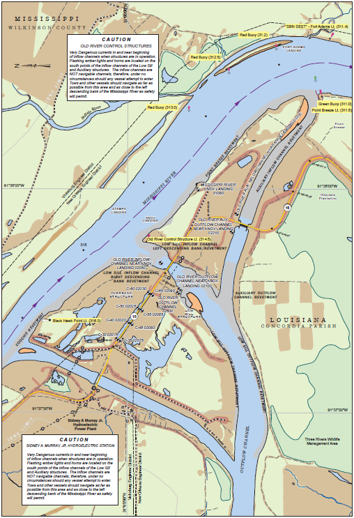 |
The 2007 Navigation Book has been designed to promote safe navigation for vessels on the Atchafalaya River from the Red River, LA to the Gulf of Mexico. It contains 48 charts which encompass this area.
The book is in PDF form and requires special software, such as Adobe Acrobat to view.
Download Complete Navigation Book (~125.9 MB)
|