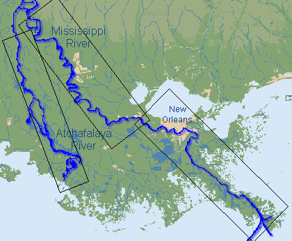
Select a section of the Mississippi River or the Atchafalaya River in order to view Revetment locations. If you have Microstation CADD software,
you may want to download the design file with all of the revetment footprints. |
DISCLAIMER: This survey information is accurate as of the date of publication. Hydrographic survey data is subject to change rapidly due to several factors including but not limited to dredging activity and natural shoaling and scouring processes. The U.S. Army Corps of Engineers accepts no responsibility for changes in the hydrographical conditions which develop after the date of publication.
NOTICE: This information is intended for the internal use of the U. S. Army Corps of Engineers and is being provided for external use as a public service. This agency accepts no responsibility for errors or omissions contained in this data. The accuracy of this data is therefore not guaranteed, and prudent mariners should not rely solely upon it.
The POC for this page:
Mathew Crawford, P.E.
New Orleans District
Channel Improvement Coordinator
504-862-1428
CEMVN-ED-CC
New Orleans, LA
Updated: 22 January 2020