 Project Purpose
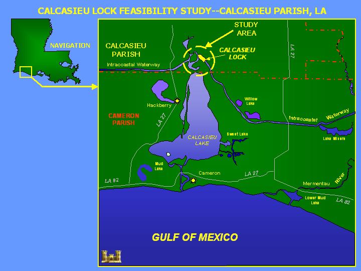
The Calcasieu Lock, LA is a feature of the Gulf Intracoastal Waterway (GIWW) system. The lock facilitates navigation and prevents saltwater intrusion from the Calcasieu River into the Mermentau River Basin, a major agricultural area. The Calcasieu Lock is the second busiest lock in the Nation, and is a vital component for the transportation of petrochemical products along the GIWW.
Project Location
The Calcasieu Lock is located on the GIWW, just east of the Calcasieu River, in Cameron Parish, LA, approximately 10 miles south of Lake Charles, LA.
Project Features
The lock was completed in 1950 and has dimensions of 13 ft deep, 75 ft wide and 1,206 ft long. The lock is structurally sound; however, increased traffic is causing congestion and navigation delays. Significant navigation delays are being experienced during high water events in the Mermentau Basin when the lock is closed to navigation and used to relieve flooding in the area. Water velocities through the lock during these drainage events create unsafe conditions for navigation.
In an effort to address these navigation delays and maintain drainage for the Mermentau Basin, the U.S. Army Corps of Engineers, New Orleans District is conducting the Calcasieu Lock Navigation Feasibility Study to determine the benefits of replacing the existing Calcasieu Lock. The principal issue addressed by the feasibility study is the delay to navigation caused by operation of the Calcasieu Lock for drainage of the Mermentau River Basin. Significant modeling efforts have been completed to document the economic impact of using the lock for flood control/salinity intrusion. The primary opportunities considered by the feasibility study are to reduce or eliminate commercial traffic delays, and to improve the national and regional economic conditions.
Project Status
The Calcasieu Lock Navigation Feasibility Study is nearing completion and the Final Calcasieu Lock Integrated Feasibility Study and Environmental Impact Statement is now available for public review. The Final Report identifies Alternative 1: Culvert Structure South of the Existing Calcasieu Lock as the Tentatively Selected Plan (as seen in graphic above). This selected plan includes a 75 ft wide gated structure and a drainage canal, and would alleviate navigation hazards and delays by creating a drainage conduit separate from the lock structure. The existing Calcasieu Lock would remain in place and continue to service barge traffic on the GIWW.