Official Project Name:Calcasieu River & Pass, LA Operations and Maintenance Location
LOCATION:The Calcasieu River is a 68 mile deep draft navigation channel located in southwest Louisiana.The northern boundary of the ship 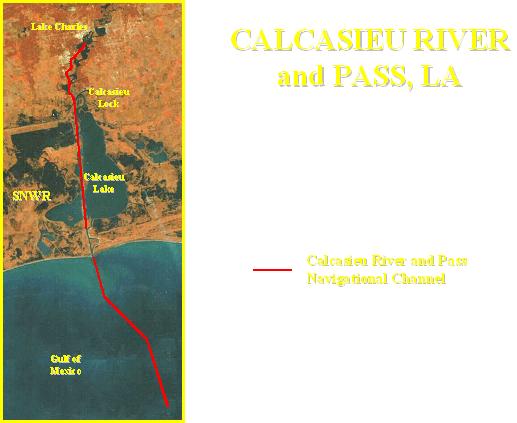 channel is located at Mile 36.0, just south of Interstate 10 in Lake Charles, LA. The southern boundary extends to Mile (-32.0) in the Gulf of Mexico.
Purpose:Provides deep draft access to the Port of Lake Charles, which is currently the 13th largest port in the nation based on tonnage. The project also provides for a salt-water barrier structure located north of Lake Charles, approximately 3 miles north of the northern boundary of the deep draft ship channel.
Authority:The project is authorized under the River & Harbor Act of 14 July 1960 House Document 436,86th Congress, 2nd Session. Authorized dimensions are -42 feet MLG by 800 feet from the jetties to Mile (-32.0) in the Gulf of Mexico (bar channel), and -40 feet MLG by 400 feet from the jetties to Mile 36.0 in Lake Charles, LA.
Scope: The bar channel requires dredging one to two times per Fiscal Year. The inland reaches between Mile 5.0 and 28.0 require dredging every other year, alternating between Mile 5 and Mile 17 and Mile 17 and Mile 28 every other year, and the uppermost reaches between Mile 28.0 and 36.0 require dredging every 5 to 8 years. The Salt-Water Barrier Structure is operational 7 days a week,
from 6:00 a.m. until 10:00 p.m Monday through Thursday and from 6:00 a.m. until 12:00a.m (midnight) on Friday and Saturday.
Progress to Date: The project is operated and maintained annually as described in the Project Scope above.
Partner/Sponsor: Lake Charles Harbor and Terminal District