Lower Mississippi River Comprehensive Management Study

The Morganza and the West Atchafalaya floodways follow down on opposite sides of the Atchafalaya River until the end of the levee system along the Atchafalaya River is reached; there they merge into a single broad floodway that passes the flow to the Gulf through two outlets, Wax Lake and Berwick Bay.
The Birds Point New Madrid Floodway not only protects Cairo, Ill., but also 2.5 million acres of land in Missouri, Arkansas, Kentucky and Tennessee. The floodway was operated during the floods of 1937 and 2011.
The Mississippi River is the main stem of a network of inland navigable waterways which form a system of about 12,350 miles in length. These waterways connect America’s heartland to the global economy through deep draft ports in South Louisiana.
The construction staff at the Old River Auxiliary Structure June 6, 1985, constructed after the low-sill structure was damaged during the Mississippi River Flood of 1973.
A view of the nearly-completed Morganza Control Structure (September 1953).
The Bonnet Carre Spillway is located approximately 30 miles upriver from New Orleans. Construction was completed in the early 1930s.

Public Outreach Information

Quarterly Public Update (Oct. 3, 2024)
The video is available on YouTube here

Quarterly Public Update Slides (October 3, 2024)

Quarterly Public Update Slides (June 20, 2024)
The video is available on YouTube here

Scoping presentation slides Spring 2024​
The video is available on YouTube here

Quarterly Public Update Slides (Jan. 23, 2024)
The video is available on YouTube here


Public Update Meeting Video

Contact Us

About


PROJECT PURPOSE/STUDY SCOPE:
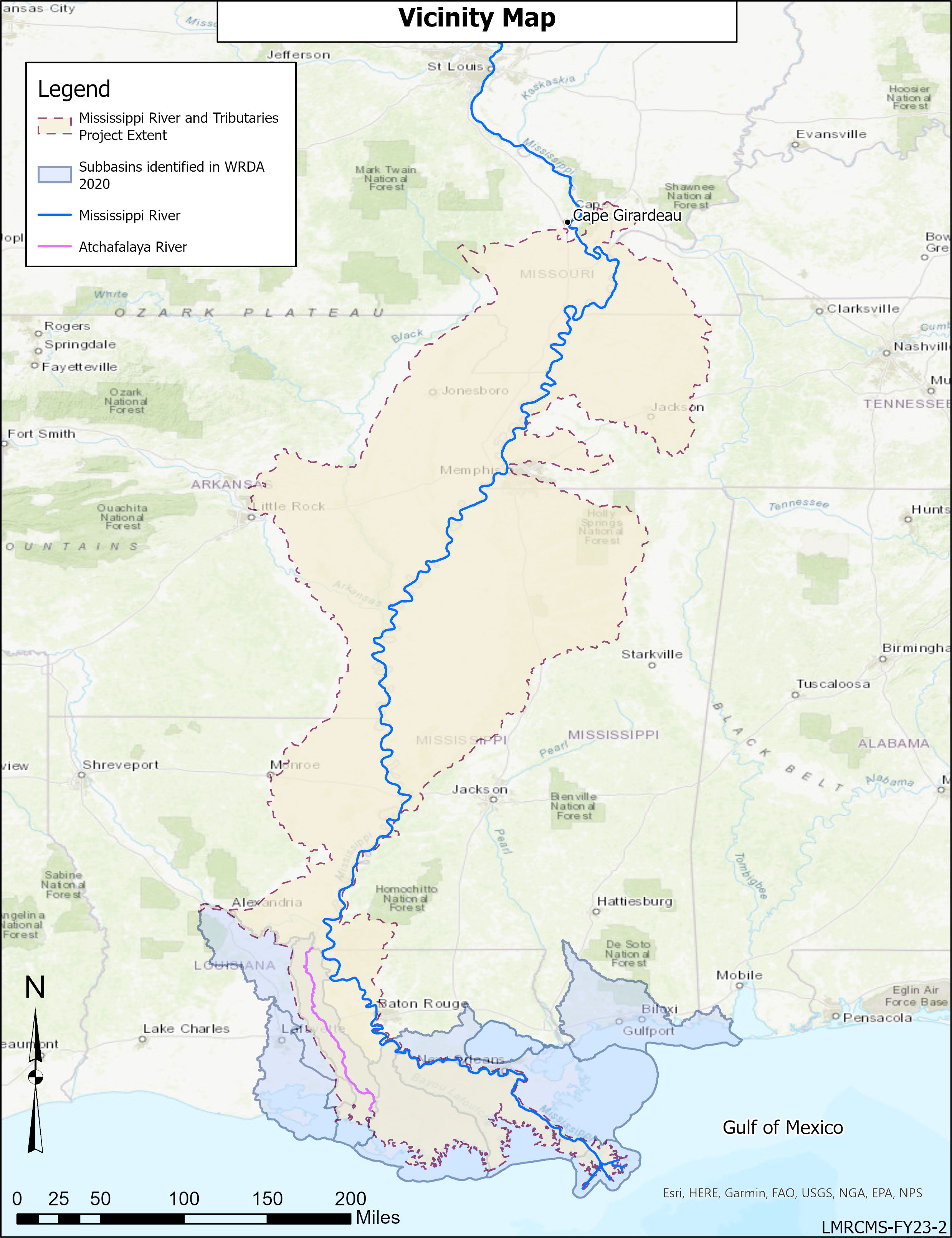
The Lower Mississippi River (LMR) Comprehensive Management Study is a 5 year, $25M, Mega Study that will evaluate alternatives for ensuring effective long-term management of the Mississippi River from Cape Girardeau, to the Gulf of Mexico. The study will look to evaluate all operations and management aspects of the lower Mississippi River and Tributaries (MR&T) system in an adaptable, resilient, and sustainable manner. This Regional study team shall conduct a study of the LMR basin for the purposes of hurricane and storm damage reduction, flood risk management, structural and nonstructural flood control, floodplain management strategies, navigation, ecosystem and environmental restoration, water supply, hydropower production, recreation, and other purposes as determined by the Secretary of the Army. USACE will execute the study in consultation with applicable Federal, State and local agencies, Tribes, non-Federal interests, and other stakeholders. In accordance with the authorities for the Mississippi River and Tributaries (MR&T) project, the Study shall develop and provided actionable recommendations to Congress.


PROJECT AUTHORITY:
Section 213 of the Water Resources Development Act (WRDA) of 2020

  • Authorizes the Secretary of the Army to conduct a comprehensive study of the Lower Mississippi River Basin, from Cape Girardeau, Missouri, to the Gulf of Mexico, to identify recommendations of actions to be undertaken under existing authorities, or after congressional authorization, for the comprehensive management of the basin for multiple purposes.

Section 8343 of the Water Resources Development Act (WRDA) of 2022

  • Mandates that the mega study will be 100% federally funded.


STUDY AREA:
The Lower Mississippi River Basin, from Cape Girardeau, Missouri, to the Gulf of Mexico.

  • Includes the states of Louisiana, Mississippi, Tennessee, Arkansas, Missouri, Kentucky, and Illinois


OPPORTUNITIES

The Ability to Study the Mississippi River with a comprehensive perspective, including flood control, navigation, ecosystem restoration, hydropower, recreation, water supply and overall life safety, provides an unprecedented opportunity to establish the foundation for a sustainable and contemporary river system.

An important early step in the study process is consideration of the full scope of these opportunities that can be evaluated within the Lower Mississippi Comprehensive Management Study as well as those that require tiered study using existing or new authorities.

The following are examples of some of the early opportunities identified by the USACE technical team:

  • Maximize beneficial use of dredge material and sediment in the water column that passes through natural crevasses and engineered diversions below Mississippi River Levee system to protect the navigation channel, enhance coastal wetland restoration, and contribute to delta building.
  • Manage Mississippi River & Tributaries system performance for contemporary needs and adjust system in response to ongoing basin change. Evaluate tradeoffs between Flood Risk Management, Navigation, and Ecosystem Restoration priorities.
  • Optimize operational scenarios or the modification of existing infrastructure to re-introduce hydrologic connectivity to floodplain areas


COMMUNICATION AND COLLABORATION

The authorized study area includes portions of seven states. The effort to evaluate this large area is being led by the USACE Mississippi Valley Division and New Orleans District with significant contributions and support by the Vicksburg, Memphis and St. Louis districts, the USACE Engineer Research and Design Center and USACE Centers of Expertise. 

In addition to leveraging resources internal to USACE, we will seek the expertise and insight of federal, state, and local agencies; tribal governments; non-federal interests and stakeholders such as academia and industry; environmental justice and overburdened communities; and the general public. Whenever practicable and appropriate, we will use existing data and information provided by these groups or other relevant multi-state monitoring programs.