Official Project Name 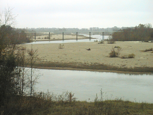
Amite River and Tributaries Ecosystem Restoration
Location
The 2,200-square-mile Amite River basin is located in Southeastern Louisiana and Southwestern Mississippi. The project is bounded by the Louisiana / Mississippi state line to the north and just south of Denham Springs (Ascension Parish) to the south. Other parishes within the study boundary include East Baton Rouge, Livingston, and Iberville.
Purpose
This feasibility study examines structural and non-structural means for reducing environmental impacts to the river corridor.
Status
A feasibility Cost Share Agreement (FCSA) was executed on 21 March 2003 between the Pontchartrain Levee District and the US Army Corps of Engineers. This FCSA allows signifies the start of the feasibility phase of the project. This project is still active.
Benefit to the Community & Project Features
Benefit to the Community
Fish and wildlife habitat has been directly degraded in approximately 25 miles of the Amite River, with potentially many more miles indirectly impacted. This degradation is believed to have been caused by urbanization, sand and gravel mining, agricultural and forestry practices over the last 50 years. Bottomland hardwoods, other forested habitats, and biodiversity continue to decrease as vegetation is removed. Approximately 10,000 to 12,000 acres have been directly disturbed in the study area. The degradation includes a reduction in wildlife habitat, stream and floodplain environment, and aggravation of existing flooding problems. Problems can be attributed to the following: wider floodplain and shallower water depths, reduction in river length and the resulting steepened river gradient, reduction of the sinuosity through meander cut-offs, increased turbidity, and an increase in the unvegetated areas and man-made changes within the river corridor. As the habitat deteriorates, wildlife that uses the river and floodplain ecosystem decreases in quantity, quality, and diversity. The study will determine the feasibility of restoring the Amite River ecosystem to less-degraded, more natural system.
Features
Proposed measures to reduce damages include channel training, bank stabilization, and sediment control. These alternatives will be evaluated for environmental compatibility.
Authority
The study was authorized by a resolution of the Committee on Transportation and Infrastructure of the U. S. House of Representatives adopted on 23 July 1998.
Scope
Approximately 10,690 acres have experienced degradation of fish and wildlife habitat throughout the basin. The degradation can be attributed to the following: wider floodplain and shallower water depths, reduction in river length and the resulting steepened river gradient, reduction of the sinuosity through meander cut-offs, increased turbidity, increased temperature, an increase in the unvegetated areas and man-made changes within the river corridor. This degradation is suspected to be causing increased flood damages, and restoration would reduce flood stages. The heel splitter mussel, a threatened species, exists in the basin and is vulnerable due to the degraded stream conditions. Project implementation may significantly contribute to the watershed management objectives of the State of Louisiana. Cost of the Feasibility study is approximately 5.2 million. The Reconnaissance report was approved in October 2000.