Hurricane & Storm Damage Risk Reduction System Improvements
This page contains an overview and specific information about improvements that USACE is making to the Greater New Orleans Hurricane & Storm Damage Risk Reduction System (HSDRRS).
 |
Overview of the Inner Harbor Navigation Canal Surge Barrier project
The Inner Harbor Navigation Canal (IHNC) surge barrier project aims to protect New Orleans East, Metro New Orleans, the 9th Ward and St. Bernard Parish from storm surge coming in from the Gulf of Mexico and Lake Borgne. |
 |
Overview of the St. Bernard Risk Reduction Project
In St. Bernard Parish, the perimeter system known locally as the Chalmette Loop Levee System is comprised of nearly 23 miles of floodwall and 12 steel floodgates between Bayou Bienvenue and the Caernarvon Canal. View this animation to learn more. |
 |
MRGO Ecosystem Restoration Video
The US Army Corps of Engineers, New Orleans District, together with our partners, is developing a comprehensive ecosystem restoration plan for the Lake Borgne ecosystem and other areas affected by the MRGO navigation channel. |
 |
West Return Floodwall
A new robust concrete T-wall will be constructed in Jefferson Parish 35 feet west of the existing West Return Floodwall. The animation shows the process of building a new floodwall and demolition of the existing floodwall. |
 |
Lake Pontchartrain Causeway
Construction of an overpass bridge and a concrete T-wall at the south shore of the Lake Pontchartrain Causeway will be phased. View the animation to learn more.. |
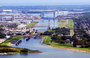 |
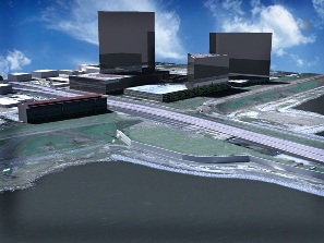
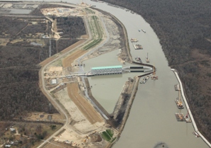
IHNC Lock Replacement
An overview of the proposed replacement project of the Inner Harbor Navigation Canal Lock. |
 |
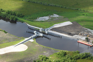
Eastern Tie-In
The Eastern Tie-In project connects the Westbank and Vicinity portion of the hurricane system into the Mississippi River levees in Plaquemines Parish. |
 |
Western Tie-In
The Western Tie-In project connects the Westbank and Vicinity portion of the hurricane system into the Mississippi River levees in St. Charles Parish. |
 |
Hurricane & Storm Damage Risk Reduction System (HSDRRS) Flyover
The Greater New Orleans Hurricane & Storm Damage Risk Reduction System is comprised of numerous features including levees, floodwalls, floodgates, surge barriers and pump stations. This computer-generated video provides an aerial "flyover" view of the entire System and improvement efforts. |
 |
GIWW West Closure Complex Rewatering
Time lapse video taken from the new north levee during rewatering. |
 |
West Closure Complex Alternatives
This video outlines the four construction alternatives that were under consideration to reduce risk to the Westbank. To view a video explaining the selected alternative, see the next video: GIWW West Closure Complex. |
 |
GIWW West Closure Complex
The selected construction alternative to reduce risk to the Westbank. To review all considered alternatives, see the previous video: West Closure Complex Alternatives. |
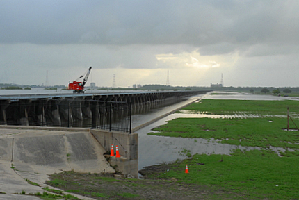 |
The Bonnet Carre Spillway Story
The Bonnet Carre Spillway is located 30 miles upstream from New Orleans in St. Charles Parish, Louisiana. The spillway protects New Orleans and other downstream communities during major floods on the Mississippi River. |